

Fair start detection for every participant
This release fixes how the leaderboard finds each participant's start read. It works for individual starts, and a new setting covers mass starts. The public event list is also easier to use: on a phone you now see several events per screen, and on a larger screen the filters you have set are easy to see. The 1D elevation chart on the tracking map now does exactly what you click.
What's new
Every participant gets the start they actually made
In the Leaderboard, participants who start one by one now get the right start time. Before, someone who switched on their tracker and then waited a few metres past the start line had the whole wait added to their time. Someone whose next location arrived far past the line, or who warmed up on the course first, got no start and no rank at all. The leaderboard now takes the participant's last location near the start and places the start back on the line. It also knows when a participant returns to the start after a warm-up.
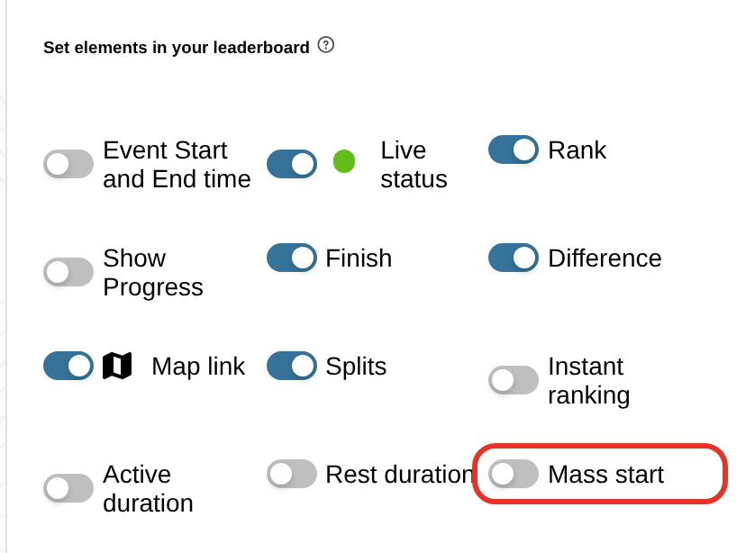
For mass starts, switch on the new Mass start option in the leaderboard editor, under the visible elements. Every participant without an uploaded or detected start then gets the event start time, with a "gun" marker. A participant who still has no start no longer shows misleading durations. The row says "no start", shows split times as time of day and sorts to the bottom, and the CSV export leaves those durations empty. Read more in the GPS timing guide.
See at least three events on one phone screen
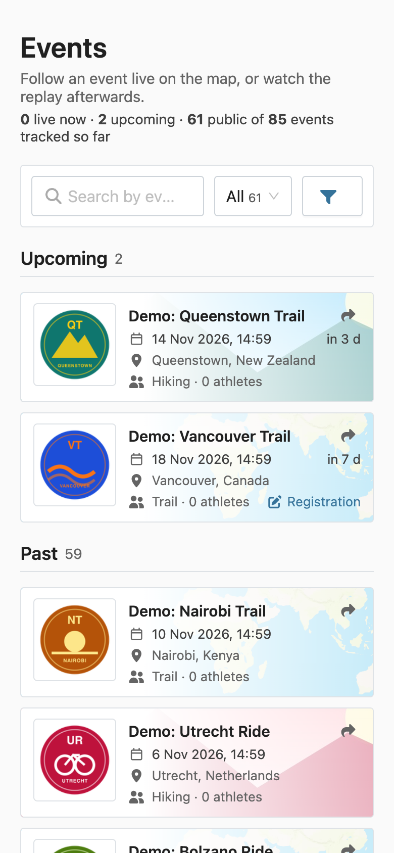
On a phone, the public event list now shows compact rows instead of one large tile per screen. Search, filters and at least three events fit on the first screen. Each row shows your event's logo and banner, its name, date, location, sport type and number of participants. It also shows Results and Registration links when your event has them. The search, status and sport filters fit in one row.
On racemap.com, tapping a row opens the event's tracking map in the Racemap app if it is installed, and in the browser if not. Shared links still point to the web page.
See which filters are active in the event list
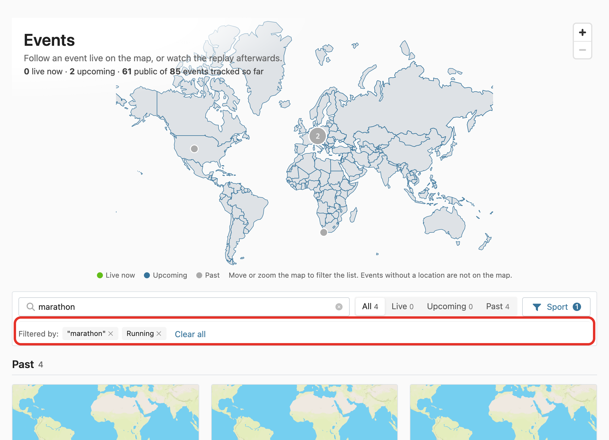
On larger screens, the public event list now puts its title on top of the map. Search, status and sport share one compact toolbar. While a filter is active, a "Filtered by:" row lists your search term, each sport and the map area as chips. Click a chip to remove that filter, or click Clear all to reset everything.
The 1D elevation chart switches exactly when you tell it to
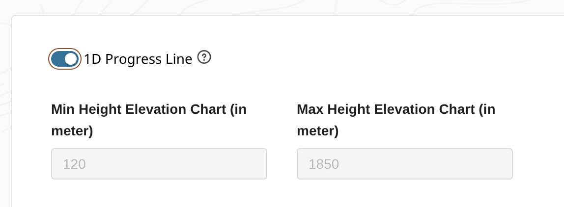
For the tracking map in Live visualization, the elevation chart's 1D progress line now has a setting of its own. Before, the 1D mode was hidden in the height fields: entering 0 as both minimum and maximum height switched the chart to 1D. And if a height field still had focus when you clicked the switch, the chart could end up in the opposite mode. Now the switch does what you click. Your minimum and maximum heights stay as you set them when you turn 1D on and off. A maximum at or below the minimum can no longer hide the elevation profile.
Other changes
- Only the owner of a SIM card can now view it, activate or pause it and send SMS to it, along with their organization and Racemap.
- Alerts, notifications and connection status can now only be read by people with access to the tracker, participant or event.
- Groundwork for our own map styles (Terrain, Streets, Satellite, Hybrid, Dark and Light) and a workbench to edit them. They are not in the app yet.
- A draft hiking map style, the starting point for the Terrain style.
- The outdoor map style on our tile server shows its icons again.
- Contour line generation is more robust and about three times faster.
- A typo fix in the documentation and cleanup of images it no longer uses.